WELCOME

Thank you for logging on. It is hoped that you will enjoy reading about our outdoor experiences from the Appalachian Trail in the East to the Pacific Crest Trail in the West and everything in between. If you have questions about Carl's gear or need information on backcountry hiking, the AT and/or PCT, don't hesitate to email either one of us: sgoodman5815@gmail.com or goodmanATRidgerunner@gmail.com.


6/26/08

DAY 60: Jun 26. 10 mi day: TOTAL Miles 1018.3


We had an easy 10 miles hike to Sonora Pass over 10,880 elevation. We will not reach this elevation again on the PCT. We came up to the pass and were greeted by Hank from Alto Palo who had a delicious layout of fruit and desserts. He calls his trail magic Sonora Pass Cafe. Also, Meadow Mary served up Chili and my baby had lots of cold drinks ready.
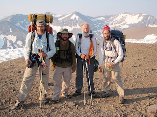
Photo #1 Slider, Gopher, Greybeard and Thrust on one of several ridges we passed over today; #2 Greybeard at 10,880 ft. elevation - the last time we will see elevation this high on the PCT; #3 Hank of Sonora Pass Cafe; #4 Cruisin, Billy Goat and Meadow Mary; #5 all of us enjoying the spread.
Keep hiking,
Greybeard

DAY 59 Reached 1,000 mile milestone: Total 1007


N 38deg 15.191, W 119 deg 35.980. Today's hike was as easy as yesterday's was hard. We have passed many beautiful (mosquito infested) meadows with big blue lakes. We finally climbed out of the last deep canyon and left the mosquitoes behind. WE HAVE REACHED A MILESTONE - 1000+ miles. Photo #1 me at the 1,000 mile marker laid down by another hiker. Photo #2 is Slider approaching my first cairn. This is just a marker in rocky areas helpful in locating the trail.
Keep hiking,
Greybeard

DAY 58, Jun.24, 20 miles: TOTAL 982.7


Today's hike was one of the most difficult with several passages and long, steep ups and downs and hordes of mosquitoes. The swampy area kept our feet soaked all day long. Shirley suggested I take Deet - and I am glad I did. We camped in Stubblefield Canyon Creek which was pleasant except for the MOSQUITOES. JZ and Gopher joined us. Coordinates N38 deg 03.566, W119 deg 35.432.

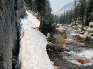
Photo #1 shows where we hike on snow-covered trail; #2 is Thrust fording a stream; #3 is me at another beautiful setting - there are so many.
Keep hiking

Greybeard

DAY 57: Mon. Jun 23.19.5 mi day. TOTAL 962.5


Hit the trail around 10 am with great terrain but hazy from the fires. We camped beneath Lodgepole Pines at Matterhorn Canyon Trail at 962.9 miles after forging Wilson Creek. We watched mule deer playing in the meadow around the camp all evening and the next morning. Coordinates: N38 deg 00.837, W 119 deg 24.893.

Photo #1 is the Mule Deer at our camp site. Photo #2 is one of the many beautiful waterfalls we encounter along the trail.
Keep hiking,

Greybeard